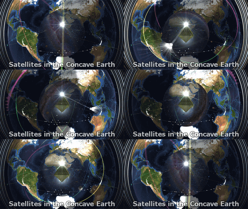
Analysis of Himawari-8 Satellite Footage: Evidence of Concave Earth
1. The Hotspot of the Sun and Light Behavior
The Himawari-8 satellite footage shows a hotspot of sunlight moving across the Earth’s surface. As this hotspot approaches the edge of the visible area, it flares outward and widens.
- Observation: When scrolling through the frames, the hotspot behaves as follows:
- In the center of the image, the light is concentrated and narrow.
- At the edges, the light source flares out and widens significantly.
- Why This Matters:
If the Earth were a convex sphere, the hotspot would shrink as it moves toward the edges, not flare out. Light on a convex surface behaves in the following way:- The hotspot is widest at the center of the sphere.
- At the edges, the light compresses and shrinks, creating a tapering effect.
The fact that the hotspot widens at the edges strongly suggests that the Earth is concave, not convex. I replicated this behavior in LightWave, a 3D modeling software:
- In a concave container, light flares outward at the edges, mimicking the behavior observed in the Himawari-8 footage.
- In contrast, light on a convex ball shrinks as it reaches the edges, aligning with traditional optics.
This visual anomaly is a significant indication that we are observing concavity rather than convexity in the satellite footage.
2. Camera Distance and the Visibility of Antarctica
The Himawari-8 satellite is supposedly 22,000 miles away from Earth in a geostationary orbit. However, this distance does not align with the visual evidence.
- Test with 3D Modeling:
- In a 3D simulation, placing a camera 22,000 miles away from a convex Earth reveals Antarctica at the bottom edge of the view.
- However, when analyzing actual Himawari-8 footage, Antarctica is not visible at all.
- What This Means:
The absence of Antarctica suggests that the camera must be much closer to the Earth than reported.- A closer camera position would eliminate Antarctica from view.
- To replicate the Himawari-8 perspective in the 3D simulation, I had to move the camera to approximately 7,000 miles away.
This discrepancy undermines the claim that the Himawari-8 satellite is 22,000 miles from Earth and further supports the concave Earth model.
3. Electro-L Satellite Footage and Landmass Shifts
Footage from the Russian Electro-L weather satellite reveals another anomaly: landmasses shift position slightly over short time periods, specifically when the Sun creates a crescent edge on the Earth.
- Observation:
- The shifting occurs when the Sun’s edge aligns with one of the Earth’s limbs (edges of the visible surface).
- This shift suggests that the camera is tilting, not orbiting around a spherical Earth.
- Why This Matters:
If the satellite were truly 22,000 miles away, such a tilt would be impossible without a massive, unrealistic movement over thousands of miles. Instead:- The camera is likely inside the Earth and tilting slightly within the concave geometry.
- The tilt aligns with the Sun’s position, indicating an interaction between the light source (Sun) and the satellite’s perspective.
4. Insufficient Darkness in Himawari-8 Frames
Another key anomaly lies in the duration of complete darkness captured by Himawari-8.
- Simulation in LightWave:
- Using accurate timeframes (144 frames for 24 hours), I simulated the Sun orbiting behind a convex Earth.
- In this simulation, there are approximately 13 frames (or 130 minutes) of complete darkness during the Earth’s night cycle.
- Himawari-8 Observation:
- Actual Himawari-8 footage shows only 4 frames (40 minutes) of complete darkness.
- This is far too short to align with the expected shadow duration on a convex Earth.
- Why This Matters:
The discrepancy suggests that the Sun is not orbiting behind a convex Earth but is instead moving within a concave Earth. The Sun’s position and light dispersion allow for more illumination and less darkness than expected.
5. Geostationary Satellites and Equatorial Equilibrium


The geostationary Himawari-8 satellite hovers in a fixed position relative to Earth. In the concave Earth model:
- These satellites reside within an equatorial equilibrium zone located inside the concave shell.
- Magnetism and gravitational forces emanating from the central region stabilize satellites at this altitude.
- Evidence of Concavity:
- The satellite’s perspective gives a wide-angle view of the Earth, almost as if observing from a bowl-like shape.
- Light refraction and bending within the concave shell create the appearance of a spherical Earth when viewed from above.
6. Operation Fishbowl and Orbital Insertion
The ability to launch satellites into geostationary orbits began after Operation Fishbowl in 1962, part of a series of high-altitude nuclear tests.
- Hypothesis:
- These tests may have broken holes in a glass-like firmament above the Earth, allowing for orbital insertion.
- Before Fishbowl, satellites like Sputnik operated below the glass sky at altitudes under 100 kilometers.
- After the tests, satellites could be “kicked” through these openings into the equatorial equilibrium zone using apogee kick motors.
- Supporting Timeline:
- Fishbowl concluded in November 1962.
- The Syncom satellites (1, 2, and 3) were launched shortly afterward, starting in February 1963.
This timeline strongly suggests that breakthroughs achieved during Operation Fishbowl allowed for the stable levitation of satellites within the concave Earth.
Conclusion
The anomalies observed in Himawari-8 and Electro-L satellite footage—such as the flaring sunlight, absence of Antarctica, shifting landmasses, and insufficient darkness—point toward a concave Earth model. The evidence indicates that:
- Satellites are inside the Earth, stabilized in an equatorial equilibrium zone.
- The Sun and light behavior align with the concave geometry, creating optical effects misinterpreted as a convex Earth.
- Historical events like Operation Fishbowl may have enabled the current satellite infrastructure.
This analysis provides compelling visual and logical evidence to reconsider conventional cosmological assumptions.


