
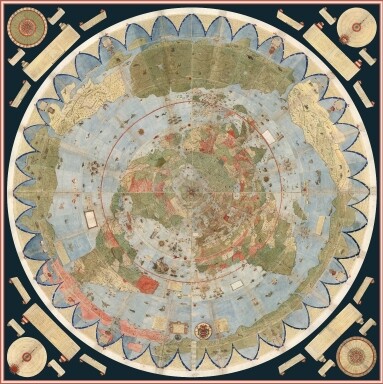
What do you think about the lunar map of the Earth? How does it work on the Concave Earth model? Here is the video, last part is about the lunar map:

My opinion : It wouldn’t work, the map isn’t like that, the continents aren’t laid out like that, and the overall flat earth model doesn’t work, especially the sun rotations for seasons
I Invite others to comment on this model , I know many are into it. Just because I don’t think it could work, doesn’t mean it can’t still be real
2 Likes
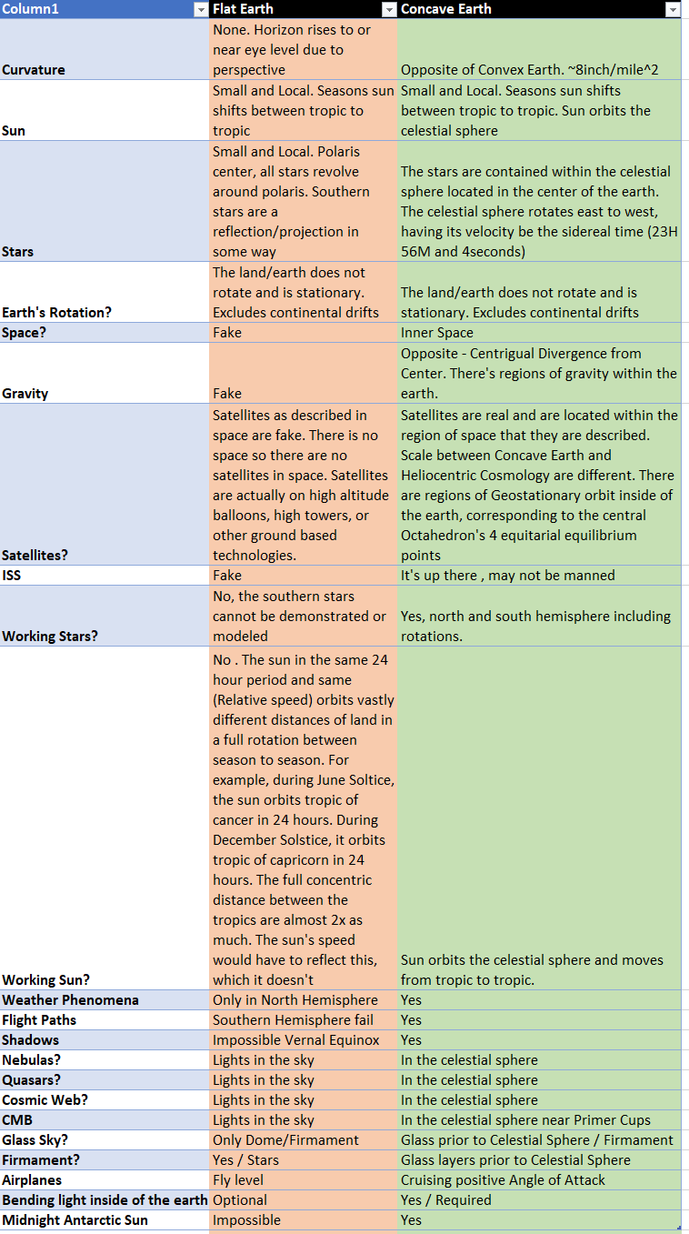
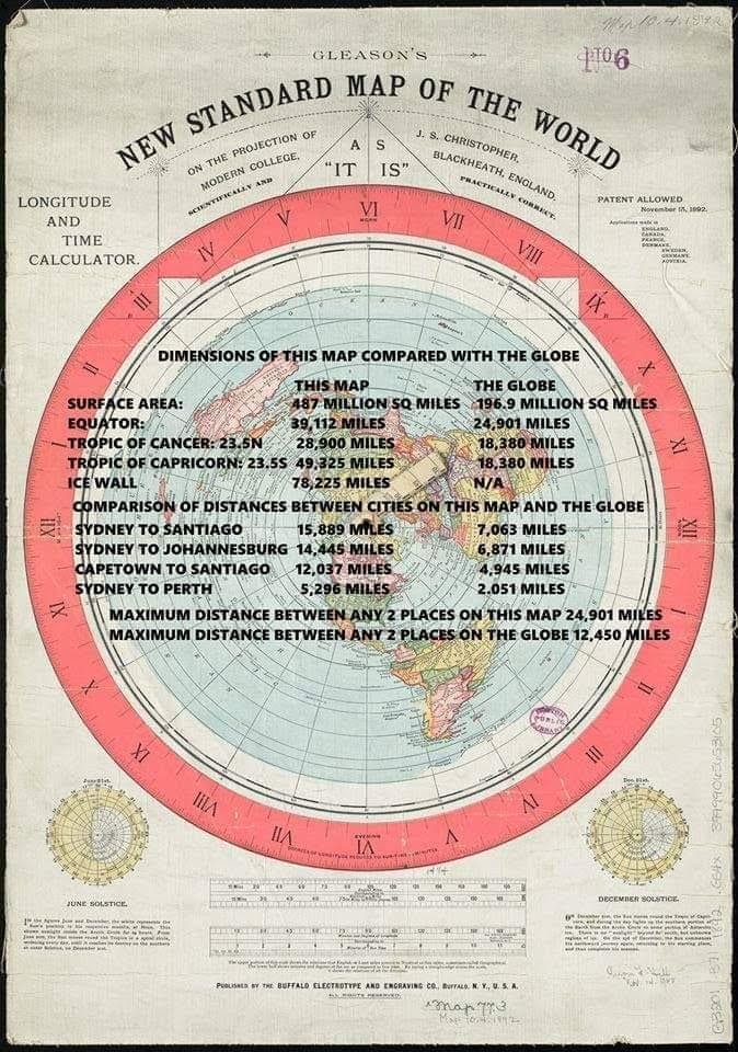
“Flat Earth” In all of it’s formss; is a mockery to intelligent design. Flat Earth is an illusion; and nothing more. The Tropics; by themselves; debunk the flat earth. In the last 7 years of the flat earth’s movement; there hasn’t been a single voyage by sea that demonstrates that the tropics are two different sizes. Yet; on every single flat earth “map” that has ever existed; clearly having 2 different sized tropics is required.
Flat Earths moon map? You mean flat earth LUNA-SEE? Sooner or later the rest of the folks in the FE camp will wake up to the beautiful simple truth of INTELLIGENT DESIGN… Or they won’t.
Their loss.
(Just realized there’s no downvote option. Unfortunate)
Sorry, I asked about how this Lunar map works on the Concave Earth, not about flat earth. Because I think the world is bigger than we know, and this lunar reflection looks like the real Earth map, but I am not sure.
No, I do believe that Earth is Concave, but I also think that Earth is bigger than we know and this map is reflection on the Moon looks like the real Earth map, I just want to know that how this map works on Concave model? There unknown big con tinents on this map.
I can’t explain to you how photo shop works in reality; merely because photo shop is not reality. The Reality; is that the tropics are the same size. There is no version of the lunacy map that coincides with reality; because it is not reality. (It’s photoshop)
Also, this image fails to be a map by every sense of the definition. No legend; no way to perform any actual navigation; no lat/long etc. This is not a map. It’s a photoshop to promote the flat earth psyop.
This is a map, and only so because it is used for aerial navigation; and cannot be used for physical seafaring navigation.
1 Like
Has it ever been used as a navigational device? Or is it more akin to a piece of art? Maps are used as a tool for physical navigation; can the image above be used to accurately navigate earth? Certainly not for the obvious reason that once again; the tropics are 2 different sizes; where as in reality they are navigated each and every day; and are determined to be the same size.
Yes, the image you posted is a “fake map;” totally useless for actual physical navigation. Would make a decent novelty item.
1 Like
yes. look at almost all ancient maps, where the world is depicted as: concave
1 Like
It’s concave, my friend - enclosed and frightening.
1 Like