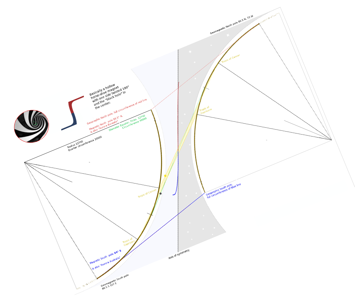
My theory of earths shape being kind of two skewed vases without bottom joined at the equator twisted around 180°. We are on the inside and the whole globe enclosed with electromagnetic field lines all converge in the center like on a round magnet.
Sun circling around the field lines (the black hole ⌀ ~60 km) in a day and alternate top to bottom in a year. Moon moves around it in 28 days. Stars in the sun shining through at tiny holes in the “black hole”.
The denser something is the more it is “in the way” of the magnetic field lines, heavier, pushed to the ground, aka gravity. No straight line to be found, yet you can measure as much as you like and its all “flat” because the inward turn to circumnavigate and the outward extension to the poles cancels each other out. Satellite tv signal is bouncing of the very dense converging electromagnetic field lines, (like billiard ball) from ground based origin. Thickness of the mantel about 300 Nautical miles (555km).
Something like:
- Geographic north pol thin red line (all the way around the rim)
- Magnetic north pole end of “vertical” red line
- Geomagnetic north pole end of brown line top right (80.5°N)
- Yellow line equator
- Geomagnetic south pole end of brown line bottom left (80.5°S)
- Magnetic south pole end of “vertical” blue line
- Geographic south pol thin blue line (all the way around the rim)
More updates to come.
1 Like
Ill note that many of my though experiments end with consciousness and physical apparent reality being a pattern of primes of primes of primes and mixed with symmetries. Look up Phase Prime Metrics.
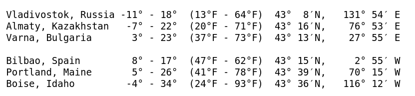
Lets look at some average temperatures (Jan-Jul) from city’s all located at 43° north parallel.
The nearer to the far extents on the right side of the map the colder. London being somewhere near the left side.
Towns further north than Titanic collision with iceberg at 41° 43′ N, 49° 56′ W
.
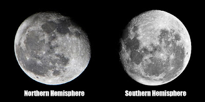
Same latitude North is much warmer as Southern counterpart.
Iceland at 65° N latitude is home of 870 species of native plants and abundant various animal life.
South Georgia Island at only 54° S latitude has only 18 species of native plants and almost no animal life.
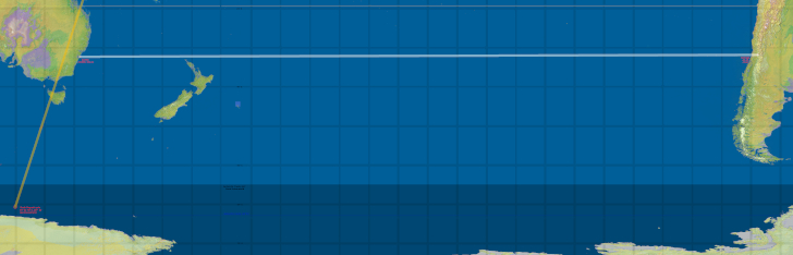
Lets look at Max Igan’s flight from Santiago Chile to Sydney Australia. He took a reasonable good compass with on board and for the entire flight the compass more or less displayed a west-south-west (or s-w-s) direction.
The onboard screen was displaying at first a SW then W and finally a NW course.
To avoid flying over the curvature a arching path is taken down south then back up.
It makes no sense, its like replacing 6 eggs with halve a dozen.
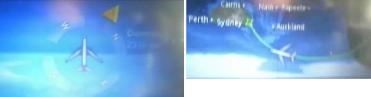
Santiago 33° 27′S, 70° 40′ WSydney 33° 52′S, 151° 12′ ESouth magnetic pole 64° 4′S, 135° 51′ E at end of the yellow line, extending up to North magnetic pole.The black vertical line is the date line.
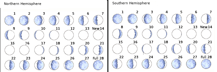
Lets look at the Moon cycles, path, waves and indentations.
28 days x 24 is 672 h it takes to complete the south-north path (S 23.4- N 23.4)
The waning and waxing (“developing”) happens in opposite direction north and south.
The path for a cycle as photographed by Giorgia Hofer Giorgia Hofer Art - Fine Art America
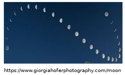
Time-lapse photography shows the Moon itself turns clockwise.
like a wheel as it circles over and around the Earth. You can find pictures of the Moon at 360 degrees of various inclination from all over the Earth simply Depending on where and when the picture is taken it can be at any inclination/tilt.
Sun and Moon always same longitudinal distance apart, dance around the black hole (playing hide and seek on eclipse).
The Lunar wave phenomen has been filmed at least 12 times with different equipment and locations.
crrow777 was the first to film it in 2012 and it can be predicted when the next will happen.
A mirror of the original footage Original 2012 lunar wave footage from crrow777 (mirror) - YouTube
Most incredible high res moon shot (Click image to see full size) the indentations look like scorch marks https://www.picturecorrect.com/photo-174-megapixel…
Direct moon light has a cooling effect, the moon is a thermal capacitor.
The Sun  diameter about 60 km (32 min, 0.53∞°) and distances at Equator Passover is ~6300 km. As i see it it’s electrical discharge/spark as it moves around the magnetic core. The shortest gap discharges longer once disconnect. It creates heat.
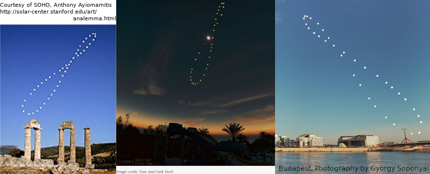
Recording the sun’s position at the same time and place every day of the year gives a figure-eight shape an analemma. Every location has its unique analemma.
As it moves around and up and down over the year
The Analemma in Antarctica The Analemma in Antarctica - YouTube
.
1 Like
Major western US and Chines recorded Earthquakes. Red and Blue dots are the Geomagnetic poles. (80.5° N and S) Purple line starting at 90° of the extended latitude.
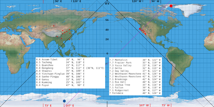
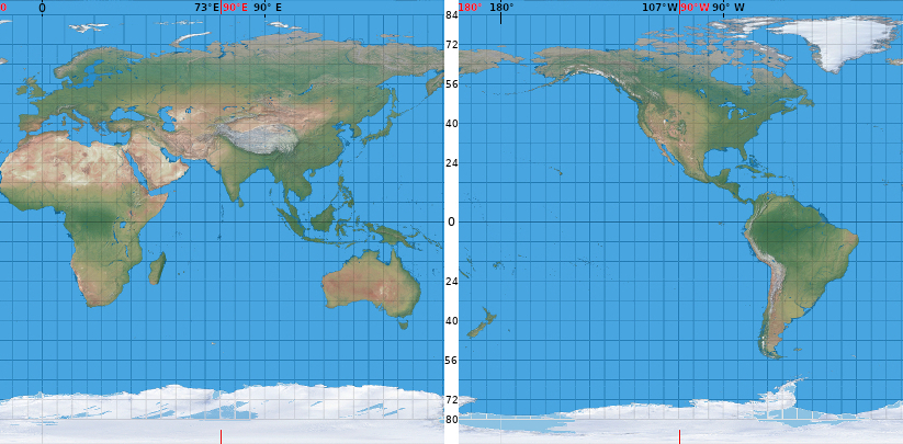
107° West and 73° East
At 107° west you will find “Truth or Consequences” in New Mexico (107° 15′ W, 33° 8′ N) and on the Antipodal point is Pakistan’s ninth-most populous city and capital Islam a bad at (73° 3′ E, 33° 41′ N)
Also at 73° E is the Gulf of Ob the world’s longest estuary.
And the earths “Navel”, the Pamir Knot/Mountains, probably the most rugged terrain on earth. What is Pamir Knot/Pamir Mountains Tajik National Park (Mountains of the Pamirs) - UNESCO World Heritage Centre
(More to come)
All round craters, none with angled trajectory impact.
Looks more like a welding burn or plasma discharge.
So realigning/moving everything by 17° (107° W - 17°, and 73° E + 17°) gives this:
Pamir Knot center on East 90° E
Truth or Consequences the center on the west side 90° W
Mainland Africa’s most western point, Cap-Vert (Dakar) at 17° W, now at 0
2:1 ratio map with UTM grid zones (MGRS grid system)
(6° every section on longitude except X 31-37, and 8° for latitude except A, B, X, Y, Z )
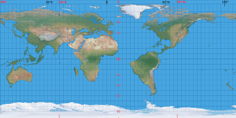
Mirrored reverse look, the right way round (Sun moving clockwise)
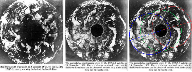
I cant vow for authenticity, website no longer exists. To be taken with a grain of salt.
The fist picture is suppose to be taken on January 6, 1967 by the ESSA-3 satellite.
The second is a photograph of the north pole taken by ESSA-7 satellite on November 23 1968The third i added some color lines with the green line representing the equator, blue and red the full circumference of the poles.