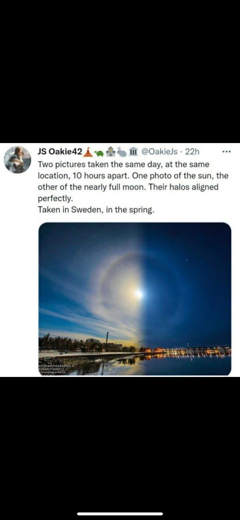
Sun and Moon the same size?
1 Like
I’ve never had a reason to believe otherwise!
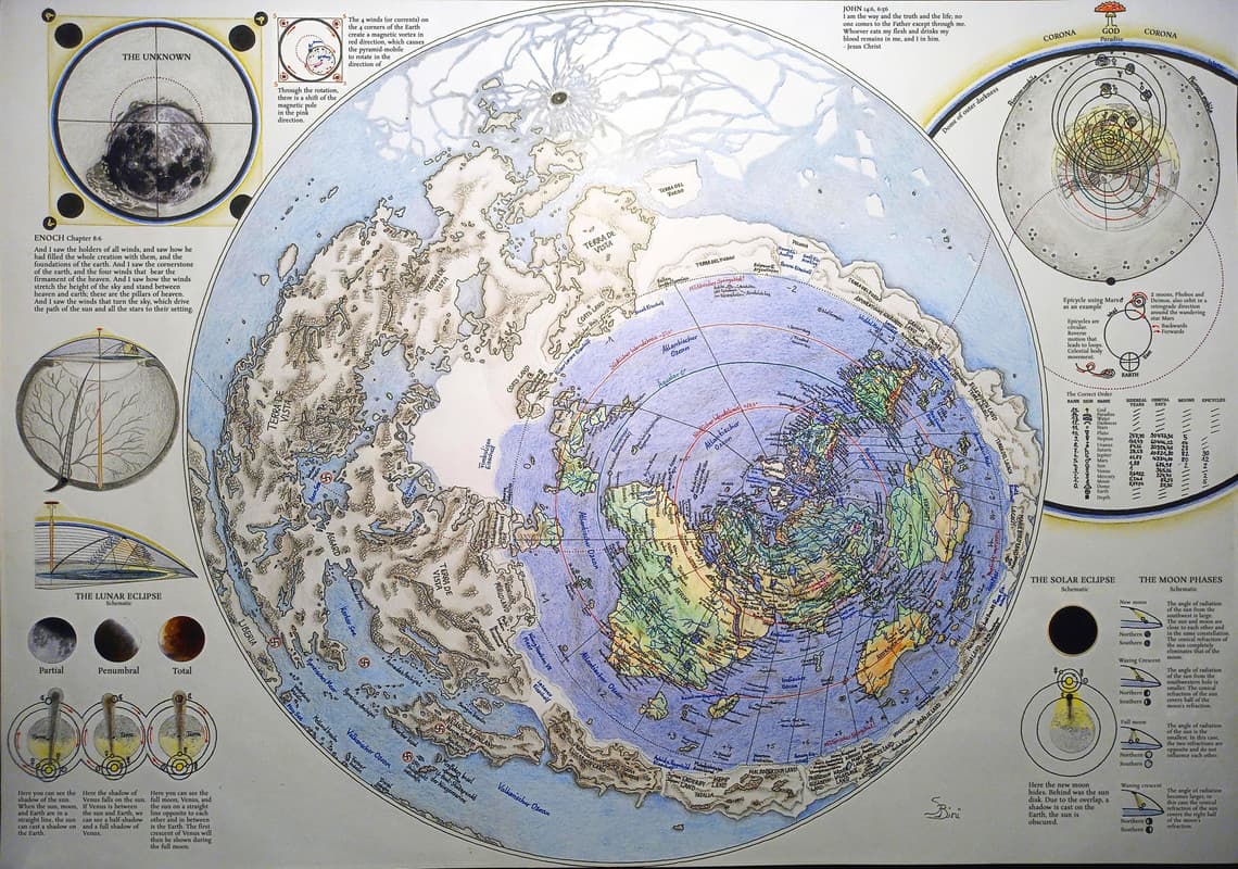
Map of the whole world when plotted on flat surface. Yes, the bases are far out of the way.
https://postlmg.cc/HJqk0kzD
What evidence was ever provided to you that the tropics are 2 different sizes, with the southern most tropic, the Tropic of Capricorn, being twice the size of the Tropic of Cancer?
Are you suggesting that every captain who has ever sailed on the Tropic of Capricorn lied in their logs about distances traveled, and supplies on board? Because in order to travel over a distance twice the size size of the Tropic of Cancer, you’d need twice the amount of supplies.
In the 4 years I studied flat earth, I realized no flat earther has ever offered actual proof that the two tropics are two totally different sizes. The best any of them have ever done is point to Captain Cook’s antartic voyage, while entirely ignoring modern day races around antartica which clearly demonstrate a much shorter distance.
In the offset Donut model (this thread) the Tropics are the same size. How you map a cylinder on a flat paper? Here is another map on a flat piece of paper.
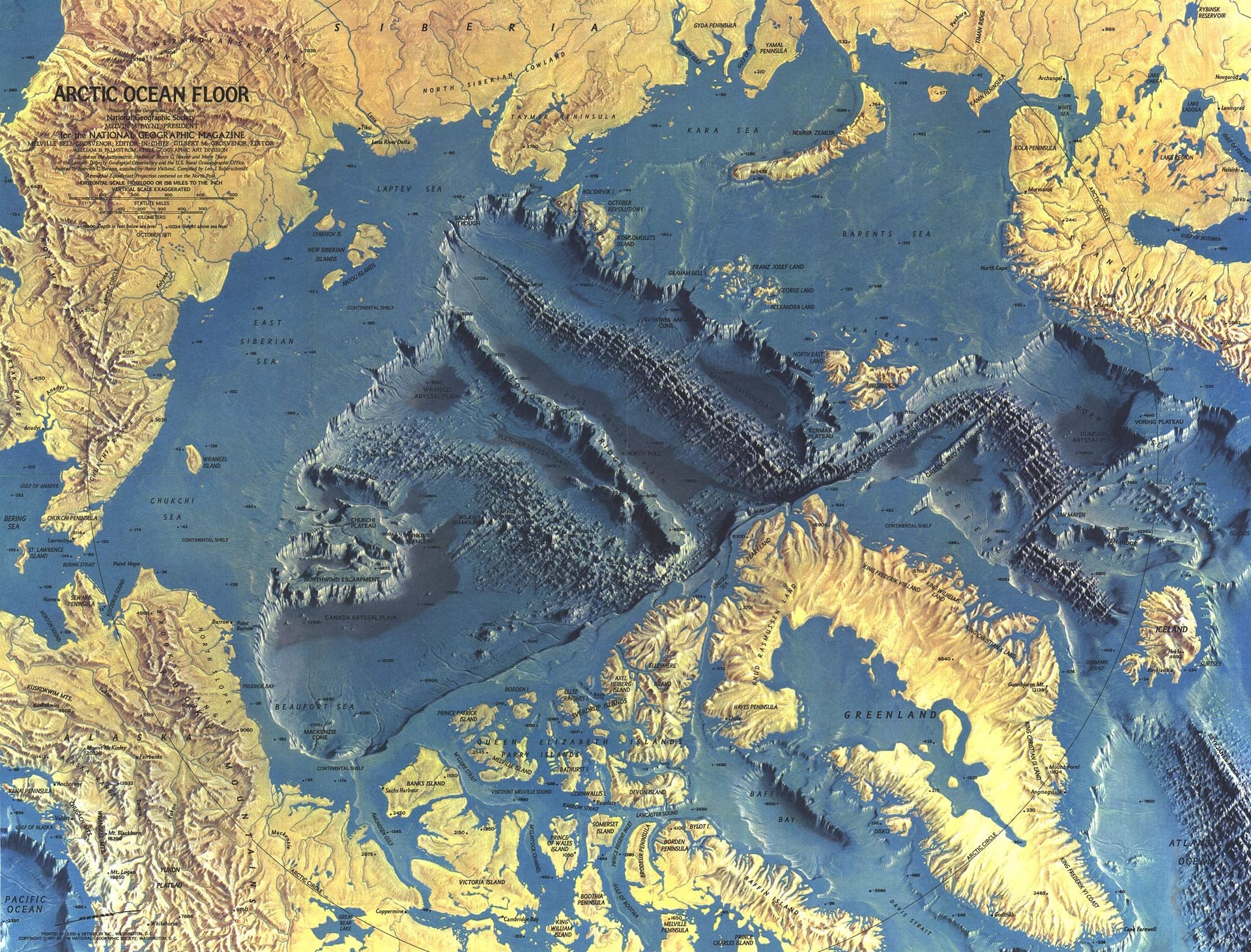
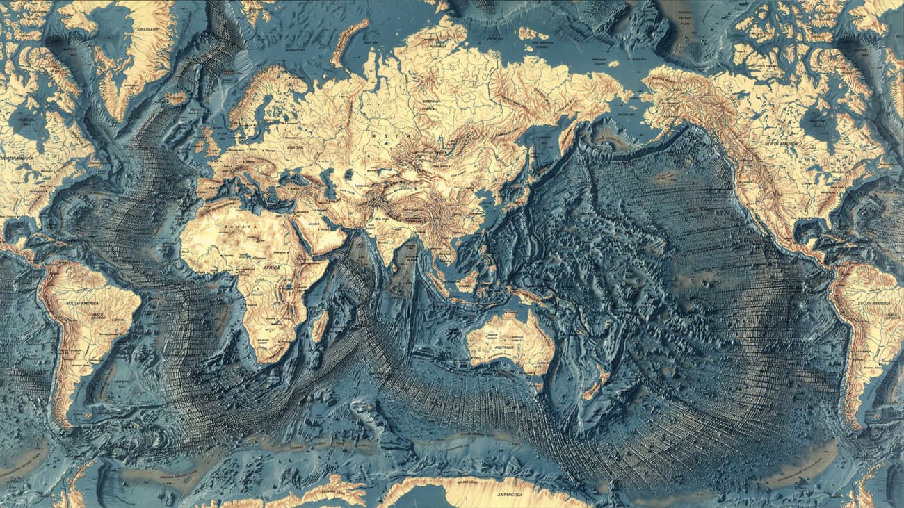
From 1971 National Geograpic the Northern most part with the Gakkel Ridge and Lommonosov Ridge. Second map of other ridges in the world.
You are claimng here, that the Tropics are the same size. Yet when you post this image:
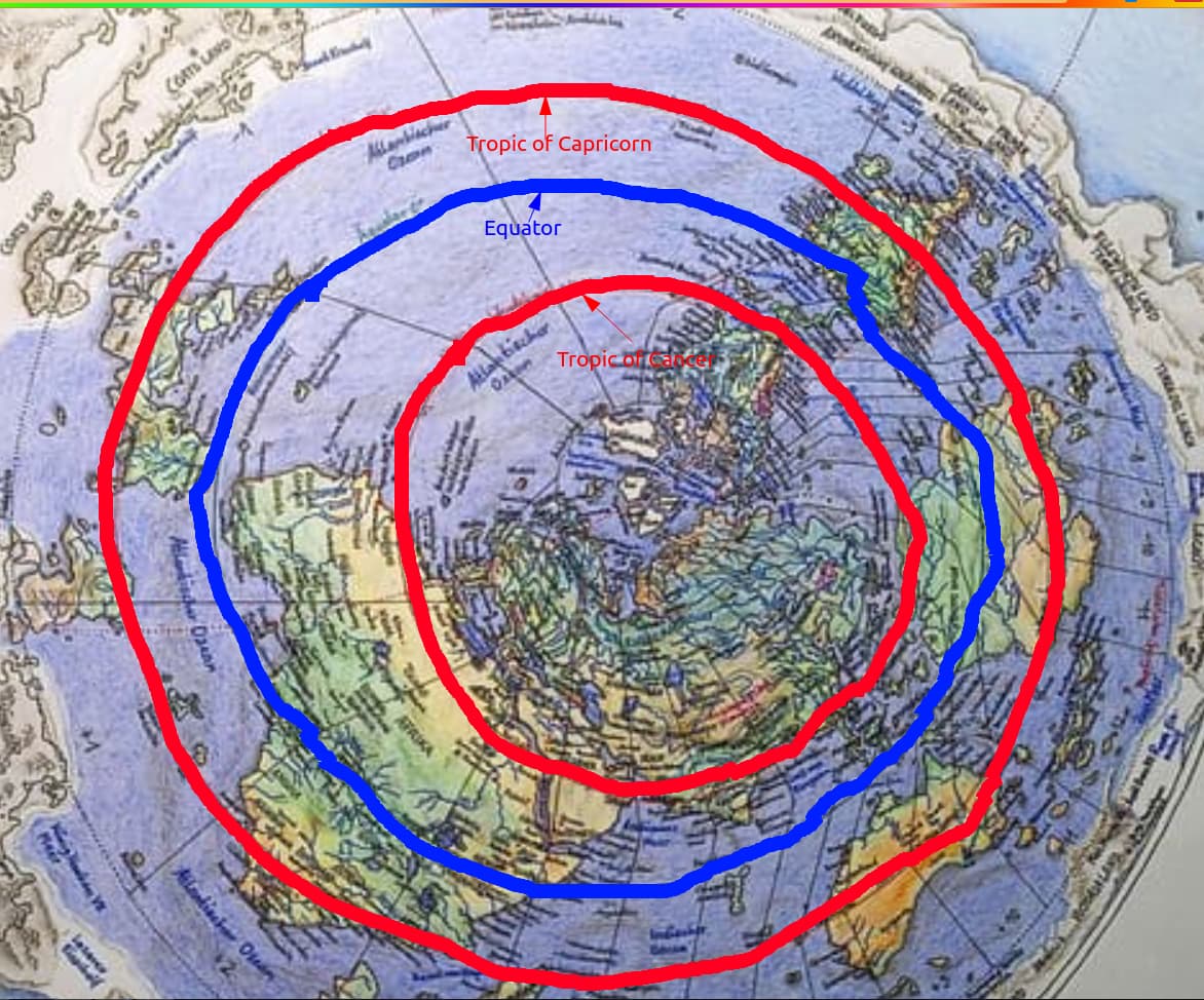
You can clearly see that the tropics are not the same size. This is one of those “can’t have your cake and eat it too situations.” Any and all concepts of “flat” earth that depict 2 concentric tropics absoltely fail the litmus test of actual reality where they are demonstrated via physical navigation to be the same size.
To best answer your question about mapping a cylinder on a flat paper, I recommend taking a look at the way ancient cartophraphers mapped the earth because as they did so they clearly did it with the understanding and intention that we live inside of earth, which is clearly demonstrated with lines of longitudinal convergence, where as modern maps now display the exact opposite effect, longitudinal divergence.
The closest thing this thread has to an offset donut in it is the nasa image with the holes at the poles. This is highly relevant because the holes at the poles are demonstrable of the toroidal nature of the world we live in. However flat maps with concentric rings do not reflect that in any way whatsover, and infact impede a persons understanding of reality when you say the tropics are the same size, when in the maps you provided (That I edited as demonstration) aren’t infact toroidal.
The very concept of having the tropics layed out in the image above pose a new plethora of questions. One of the best being; What is the increase in the suns speed as it goes into the southern tropic? Because naturally to cover a larger distance, you would an increase in speed to maintain the same amount of daylight.
I believe the holes in the poles just take you to inner earth where the most civilized and ancient of the human race still dwell.
Tropics, Equator, poles are the same size.
How you represent both sides of a cylinder on a flat piece of paper?
We live inside a bottomless vase with a rounding of edge on both sides.
Lets trick the eye with Einsteins face.

Worthy all of it, but the relevant part start at about half hour in. Sound is the creation.

What about this World, the “The smoky god” world.
https://x.com/WorldNews_X_/status/1858502921010176447?t=A576Jbj9t6zdu-ZIQI1fcw&s=19z
Outer Civilizations Exist, we are on the Inside.
From Dutch Freemason Lodge
The moon vanishing into the earth’s atmosphere, research it!
Image taken from the ISS. The moon appears to be lying on its side?
Another cornerstone, looking from the outside to the inside sun
The Philippe Buache map from 1737 showing the Transantarctic Mountains and dividing Antarctica into two landmasses separated by a narrow waterway.
